
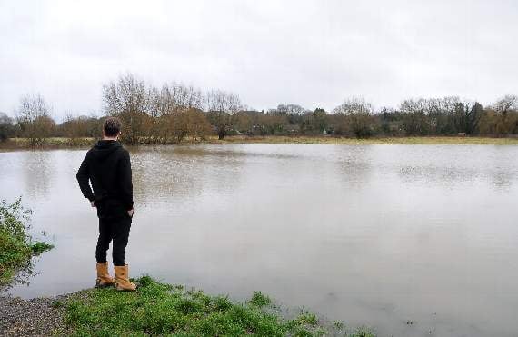
THE Environment Agency is warning that persistent heavy rain could lead to an increased risk of flooding in South West Surrey and East Hampshire over the next few days.
Forecasted heavy rain could cause surface water flooding, and see a further rise in water levels on the River Wey, with the potential for travel disruption as roads and rail lines may be affected.
At midday today, there were 82 flood alerts across the South East – including for the Upper River Wey including Alton and Farnham and the River Wey at Elstead – which means flooding is possible.
The alerts for the River Wey state: "Property flooding is possible. River levels are out of banks and rising on the Upper River Wey as a result of persistent heavy rainfall.



.jpg?width=209&height=140&crop=209:145,smart&quality=75)
"Levels are particularly high in the Elstead and Eashing area with the potential for isolated property flooding.
"Therefore, flooding of roads and farmland is expected to continue today 20/12/19.
"Persistent and at times heavy rainfall is expected to continue this morning, and further showers are forecast this afternoon and overnight with the potential to be heavy at times.
"We are closely monitoring the situation. Our incident response staff have been in the area clearing trash screens and checking defences.
"Please remain safe and aware of your local surroundings and refer to the ’River and Sea levels in England’ webpage for current river levels. This message will be updated this evening, 20/12/19, or as the situation changes."
The A31 west of Farnham at Northbrook Park was closed on Thursday evening after cars became stranded in flood water.
The Portsmouth to London train line has also been blocked by a landslide at Guildford.
Dave Bedlington, duty manager for the Environment Agency, said: “Heavy downpours across the South East have led to surface water flooding and significant travel disruption today, Friday, December 20, and may do so into the weekend.
"Due to the heavy rain, almost 70 properties will be protected by temporary flood barriers the Environment Agency has put up in Guildford, on Mary Road, through the bus depot and onto Leas Road, and at Guildford Road Bridge in Leatherhead.
“In response to recent rainfall and increasing river flows on the River Thames, the Environment Agency has operated the Maidenhead, Windsor and Eton Flood Alleviation Scheme, which includes the Jubilee River, which has been reducing the risk of flooding from the River Thames to approximately 3,000 properties in Maidenhead, Windsor and Eton since 2002.
“We are assessing three rivers in the east of the region, the Mole, the Medway and the Stour, and will issue any local flood alerts or warnings locally as required.
“Our teams have been out on the ground checking flood defences, clearing debris from rivers, and will continue to support our partners to reduce the impacts of the heavy rain. We will issue flood warnings and alerts where necessary.
“We urge the public to prepare to take action when at risk of flooding, even if a temporary barrier is in place.
"There are a number of things you can do to prepare for flooding to keep yourself and your family safe. Find out if your home is at risk, sign-up for flood warnings and be ready to take action.
"For more information, visit www.gov.uk/flood or call Floodline on 0345 988 1188.
“People should remain vigilant, check their flood-risk and plan to stay safe. We urge people to stay away from swollen rivers and not to walk or drive through flood water as just 30cm/12ins of flowing water is enough to move your car.”
People on Twitter can follow updates on flood-risk on the Environment Agency’s South East and national accounts, @EnvAgencySE and @EnvAgency.
Comments
This article has no comments yet. Be the first to leave a comment.